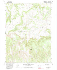
1966 Map of Limestone Hill
USGS Topo · Published 1983About this map
Douglas Mountain dominates this portion of Moffat County, rising sharply above the canyonlands and plateaus that characterize the high desert of northwestern Colorado. Surveyed in the mid-1960s, the terrain reveals a complex network of seasonal drainages including Sager Draw and Weller Draw, which carve through the prominent John Weller Mesa. The landscape is largely defined by its natural topography rather than human settlement, though a pervasive network of Jeep Trails indicates the paths used for ranching, hunting, and land management.
Find a feature on this map
18 named features on this map. Tap any name to fly to it.
Don’t see what you’re looking for? This feature index may not catch every label — zoom into the map to look around manually.
Map Details
Editions of this 1966 Limestone Hill Map
3 editions found
Other maps of this area

1907 · Rangely
USGS Topo · 1:125,000

1907 · White River
USGS Topo · 1:125,000

1910 · White River
USGS Topo · 1:125,000

1910 · Rangely
USGS Topo · 1:125,000

1954 · Vernal
USGS Topo · 1:250,000

1958 · Vernal
USGS Topo · 1:250,000

1960 · Vernal
USGS Topo · 1:250,000

1960 · Elk Springs
USGS Topo · 1:62,500

1960 · Lone Mountain
USGS Topo · 1:62,500

1962 · Indian Water Canyon
USGS Topo · 1:24,000