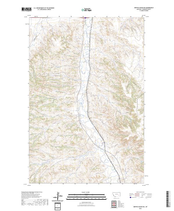
2024 Map of Griffin Coulee NE
USGS Topo · Published 2024About this map
Armells Creek flows northward through this portion of Rosebud County, carving a central drainage through a landscape defined by intricate coulees and seasonal waterways. The terrain is characterized by the convergence of several significant stream beds, including Corral Creek and the southern reach of Cottonwood Creek. The township and range lines for t6n r39e and t5n r40e intersect here, marking a survey grid over a region largely devoid of dense settlement but marked by essential rural infrastructure.
Find a feature on this map
11 named features on this map. Tap any name to fly to it.
Don’t see what you’re looking for? This feature index may not catch every label — zoom into the map to look around manually.
Map Details
Editions of this 2024 Griffin Coulee NE Map
This is the sole edition of this map. No revisions or reprints were ever made.
Other maps of this area

1954 · Forsyth
USGS Topo · 1:250,000

1957 · Forsyth
USGS Topo · 1:250,000

1958 · Forsyth
USGS Topo · 1:250,000

1968 · Nichols
USGS Topo · 1:24,000

1968 · Forsyth
USGS Topo · 1:24,000

1968 · Finch
USGS Topo · 1:24,000

1971 · Griffin Coulee SW
USGS Topo · 1:24,000

1971 · Griffin Coulee NE
USGS Topo · 1:24,000
1971 · Smith Creek
USGS Topo · 1:24,000
1971 · Sheep Creek Camp
USGS Topo · 1:24,000