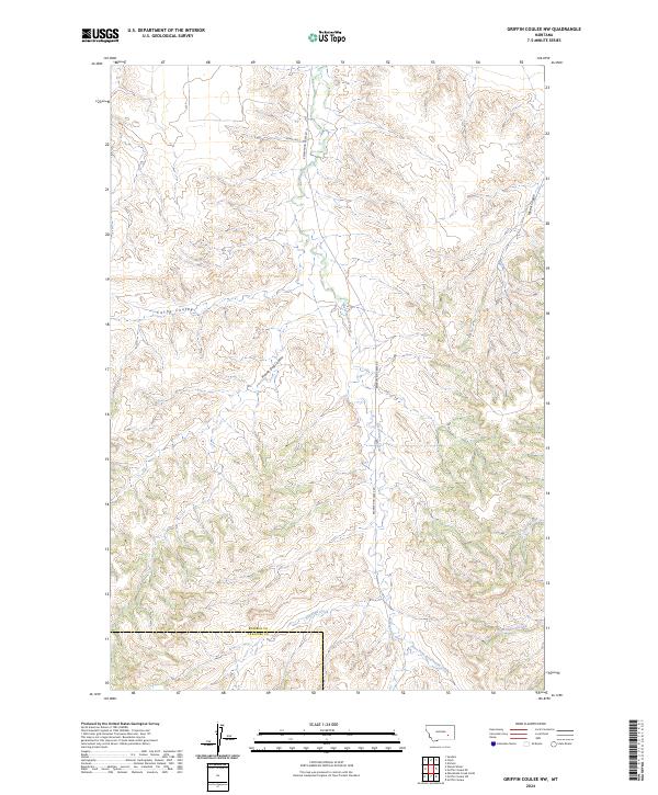
2024 Map of Griffin Coulee NW
USGS Topo · Published 2024About this map
Reservation Creek and its many winding tributaries define this topographic landscape in Montana. The terrain is characterized by a complex system of coulees and ridges, where Prairie Dog Coulee and Cache Coulee drain the western uplands. The drainage patterns shift across the landscape, eventually feeding into Blacktail Creek and East Fork Reservation Creek in the south.
Find a feature on this map
17 named features on this map. Tap any name to fly to it.
Don’t see what you’re looking for? This feature index may not catch every label — zoom into the map to look around manually.
Map Details
Editions of this 2024 Griffin Coulee NW Map
This is the sole edition of this map. No revisions or reprints were ever made.
Other maps of this area

1954 · Forsyth
USGS Topo · 1:250,000

1957 · Forsyth
USGS Topo · 1:250,000

1958 · Forsyth
USGS Topo · 1:250,000

1960 · Sanders
USGS Topo · 1:24,000

1968 · Nichols
USGS Topo · 1:24,000

1968 · Finch
USGS Topo · 1:24,000

1971 · Griffin Coulee SW
USGS Topo · 1:24,000

1971 · Griffin Coulee NE
USGS Topo · 1:24,000
1971 · Griffin Coulee
USGS Topo · 1:24,000
1971 · Griffin Coulee NW
USGS Topo · 1:24,000