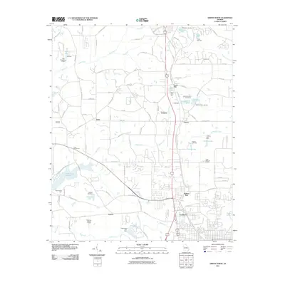
2011 Map of Griffin North
USGS Topo · Published 2011About this map
Highland Mills and the industrial community of Experiment anchor the southern portion of this landscape, representing the historic textile and agricultural research hubs near Griffin. The area is defined by a dense network of water features and small private airfields, including Halls Flying Ranch Airport and Beaverbrook Aerodrome, which suggest a character of mid-century rural development and aviation. The northern terrain is a patchwork of small reservoirs and dams, such as Miriatoto Lake and Twilly Lake, feeding into Bear Creek and Heads Creek.
Find a feature on this map
114 named features on this map. Tap any name to fly to it.
Don’t see what you’re looking for? This feature index may not catch every label — zoom into the map to look around manually.
Map Details
Editions of this 2011 Griffin North Map
This is the sole edition of this map. No revisions or reprints were ever made.
Other maps of this area

1951 · Barnesville
USGS Topo · 1:62,500

1953 · Atlanta
USGS Topo · 1:250,000

1957 · Atlanta
USGS Topo · 1:250,000

1958 · Atlanta
USGS Topo · 1:250,000

1964 · Luella
USGS Topo · 1:24,000
1964 · Mc Donough
USGS Topo · 1:24,000
1965 · Hampton
USGS Topo · 1:24,000

1965 · Fayetteville
USGS Topo · 1:24,000

1965 · Griffin North
USGS Topo · 1:24,000

1965 · Brooks
USGS Topo · 1:24,000