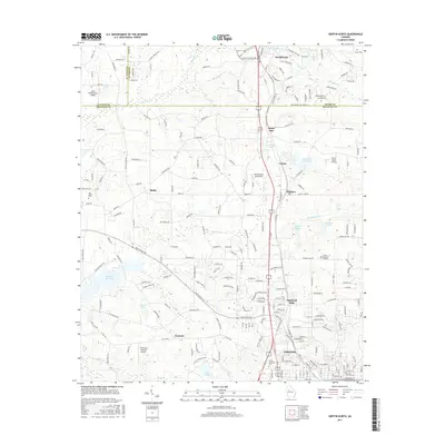
2017 Map of Griffin North
USGS Topo · Published 2017About this map
Griffin and its northern industrial and residential expansions dominate the southern portion of this landscape at the intersection of Spalding Co and Henry Co. The area is marked by a transition from the urban fabric of Highland Mills and the Griffin Technical Coll campus to the more dispersed agricultural and suburban character found near Birdie and Sunny Side. This 2017 survey reveals a sophisticated network of small private aviation facilities, including Halls Flying Ranch Airport, Beaverbrook Aerodrome, and Pinebrook Estates Airport, which speak to the region's specific transportation and recreational infrastructure.
Find a feature on this map
222 named features on this map. Tap any name to fly to it.
Don’t see what you’re looking for? This feature index may not catch every label — zoom into the map to look around manually.
Map Details
Editions of this 2017 Griffin North Map
This is the sole edition of this map. No revisions or reprints were ever made.
Other maps of this area

1951 · Barnesville
USGS Topo · 1:62,500

1953 · Atlanta
USGS Topo · 1:250,000

1957 · Atlanta
USGS Topo · 1:250,000

1958 · Atlanta
USGS Topo · 1:250,000

1964 · Luella
USGS Topo · 1:24,000
1964 · Mc Donough
USGS Topo · 1:24,000
1965 · Hampton
USGS Topo · 1:24,000

1965 · Fayetteville
USGS Topo · 1:24,000

1965 · Griffin North
USGS Topo · 1:24,000

1965 · Brooks
USGS Topo · 1:24,000