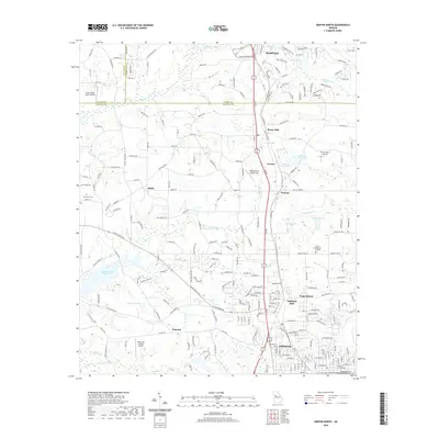
2020 Map of Griffin North
USGS Topo · Published 2020About this map
The transition from the suburban edge of Hampton in Henry County into the industrial and agricultural corridors of northern Spalding County is documented in this 2020 record. The landscape is defined by its small aviation facilities, including Halls Flying Ranch Airport and the Beaverbrook Aerodrome, which serve the communities of Sunny Side, Birdie, and Pomona. The southern portion of the area centers on the northern outskirts of Griffin, where long-standing textile-related settlements like Highland Mills and the community of Experiment appear alongside more recent residential developments.
Find a feature on this map
229 named features on this map. Tap any name to fly to it.
Don’t see what you’re looking for? This feature index may not catch every label — zoom into the map to look around manually.
Map Details
Editions of this 2020 Griffin North Map
This is the sole edition of this map. No revisions or reprints were ever made.
Other maps of this area

1951 · Barnesville
USGS Topo · 1:62,500

1953 · Atlanta
USGS Topo · 1:250,000

1957 · Atlanta
USGS Topo · 1:250,000

1958 · Atlanta
USGS Topo · 1:250,000

1964 · Luella
USGS Topo · 1:24,000
1964 · Mc Donough
USGS Topo · 1:24,000
1965 · Hampton
USGS Topo · 1:24,000

1965 · Fayetteville
USGS Topo · 1:24,000

1965 · Griffin North
USGS Topo · 1:24,000

1965 · Brooks
USGS Topo · 1:24,000