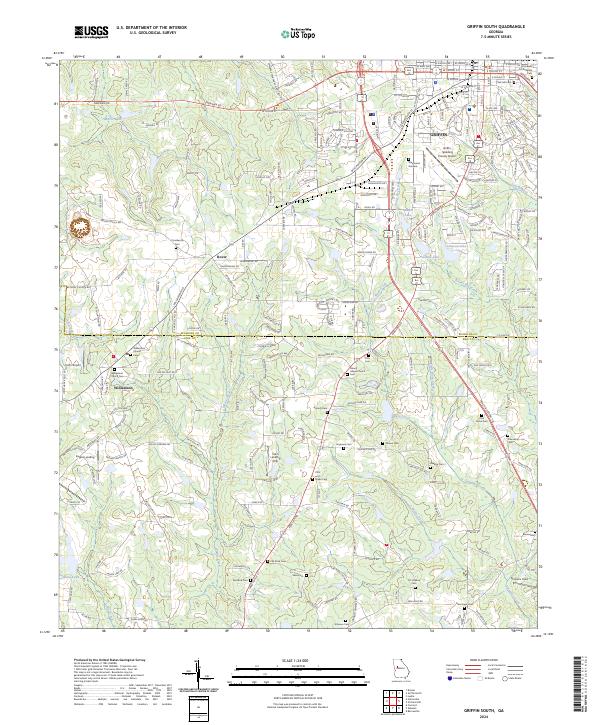
2024 Map of Griffin South
USGS Topo · Published 2024About this map
Griffin anchors the northern reaches of this Pike and Spalding County landscape, where the urban grid gives way to a network of creeks and small settlements. The area around Westwood Gardens and the Griffin-Spalding County Airport transitions into the agrarian communities of Rover and Williamson, characterized by numerous family and community burial grounds. Honey Bee Creek and Wasp Creek drain the undulating terrain, punctuated by local landmarks like the S & S Landing Strip and Kitchens Field.
Find a feature on this map
62 named features on this map. Tap any name to fly to it.
Don’t see what you’re looking for? This feature index may not catch every label — zoom into the map to look around manually.
Map Details
Editions of this 2024 Griffin South Map
This is the sole edition of this map. No revisions or reprints were ever made.
Other maps of this area

1951 · Barnesville
USGS Topo · 1:62,500

1953 · Atlanta
USGS Topo · 1:250,000

1957 · Atlanta
USGS Topo · 1:250,000

1958 · Atlanta
USGS Topo · 1:250,000

1964 · Luella
USGS Topo · 1:24,000

1965 · Griffin North
USGS Topo · 1:24,000

1965 · Brooks
USGS Topo · 1:24,000

1971 · Hollonville
USGS Topo · 1:24,000
1971 · Griffin South
USGS Topo · 1:24,000
1971 · Zebulon
USGS Topo · 1:24,000