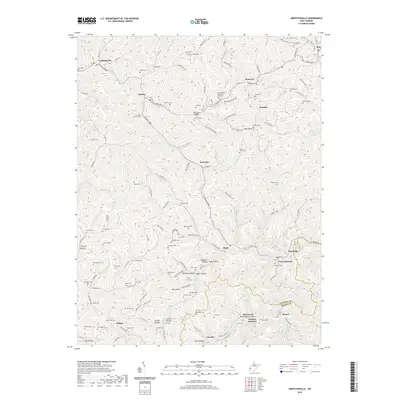
2019 Map of Griffithsville
USGS Topo · Published 2019About this map
Griffithsville and the surrounding hollows of Lincoln County define this landscape where the Lincoln and Boone county lines meet. The terrain is a complex network of narrow ridges and winding stream beds, including Bear Fork and Laurel Fork, which dictate the placement of small communities like Yawkey, Alkol, and Sumerco. Local history is deeply rooted in the family cemeteries found throughout the uplands, such as Owen Cem, Bays Cem, and Black Cem, often situated near the heads of hollows like McClure Hollow or Saw Pit Hollow. The settlement pattern follows the drainages, with roads like Midway Rd and Snowden Rd connecting isolated clusters of homes and churches along the valley floors, illustrating a traditional Appalachian mountain community structure that persists into the 21st century.
Find a feature on this map
146 named features on this map. Tap any name to fly to it.
Don’t see what you’re looking for? This feature index may not catch every label — zoom into the map to look around manually.
Map Details
Editions of this 2019 Griffithsville Map
This is the sole edition of this map. No revisions or reprints were ever made.
Other maps of this area

1892 · Huntington
USGS Topo · 1:125,000

1898 · Huntington
USGS Topo · 1:125,000

1899 · Charleston
USGS Topo · 1:125,000

1902 · Milton
USGS Topo · 1:62,500

1902 · Midkiff
USGS Topo · 1:62,500

1907 · Midkiff
USGS Topo · 1:62,500

1909 · Midkiff
USGS Topo · 1:62,500

1909 · Saint Albans
USGS Topo · 1:62,500

1911 · Madison
USGS Topo · 1:62,500

1929 · Madison
USGS Topo · 1:62,500