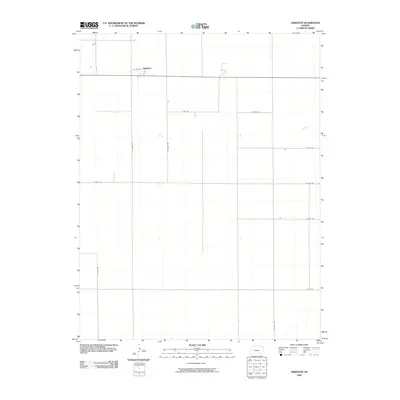
2009 Map of Grigston
USGS Topo · Published 2009About this map
Grigston stands as the primary point of settlement in this expansive Scott County landscape, centered at the intersection of E Rd 152 and S Venison Rd. The area is characterized by a strict orthogonal grid of rural roads, a pattern established by early land surveys to facilitate agricultural development. This network includes notable north-south corridors like S Willow Rd and S Union Rd, while east-west routes such as Co Rd 140 and Co Rd 120 cross the open plains. The sparse hydrography and uniform road spacing suggest a region dominated by large-scale farming operations, with the settlement of Grigston serving as a local hub for the surrounding community just after the turn of the 21st century.
Find a feature on this map
13 named features on this map. Tap any name to fly to it.
Don’t see what you’re looking for? This feature index may not catch every label — zoom into the map to look around manually.
Map Details
Editions of this 2009 Grigston Map
This is the sole edition of this map. No revisions or reprints were ever made.
Other maps of this area

1939 · Sandon
USGS Topo · 1:62,500

1940 · Scott City
USGS Topo · 1:62,500

1942 · Sandon
USGS Topo · 1:62,500

1951 · Scott City
USGS Topo · 1:62,500

1955 · Scott City
USGS Topo · 1:250,000

1958 · Scott City
USGS Topo · 1:250,000

1974 · Amy SE
USGS Topo · 1:24,000

1974 · Amy SW
USGS Topo · 1:24,000

1974 · Grigston
USGS Topo · 1:24,000

1974 · Amy
USGS Topo · 1:24,000