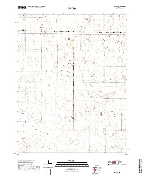
2022 Map of Grigston
USGS Topo · Published 2022About this map
Grigston anchors this rural Kansas landscape, where the agricultural grid meets the county boundary of Scott Co Lane Co. The area is defined by its extensive section lines and road networks, including S Venison Rd and Bison II Rd, which facilitate transport across the high plains. The terrain is marked by numerous small depressions and intermittent water features typical of the region's playa lake system. This survey illustrates the persistent geometry of the Public Land Survey System, with township and range lines like t18s r31w and t19s r30w providing the structural framework for land ownership and local travel. Movement through the quadrangle relies on a web of numbered and named routes such as Arapahoe Rd and N Willow Rd, reflecting the sparse but organized settlement pattern of the Western Kansas plains.
Find a feature on this map
25 named features on this map. Tap any name to fly to it.
Don’t see what you’re looking for? This feature index may not catch every label — zoom into the map to look around manually.
Map Details
Editions of this 2022 Grigston Map
This is the sole edition of this map. No revisions or reprints were ever made.
Other maps of this area

1939 · Sandon
USGS Topo · 1:62,500

1940 · Scott City
USGS Topo · 1:62,500

1942 · Sandon
USGS Topo · 1:62,500

1951 · Scott City
USGS Topo · 1:62,500

1955 · Scott City
USGS Topo · 1:250,000

1958 · Scott City
USGS Topo · 1:250,000

1974 · Amy SE
USGS Topo · 1:24,000

1974 · Amy SW
USGS Topo · 1:24,000

1974 · Grigston
USGS Topo · 1:24,000

1974 · Amy
USGS Topo · 1:24,000