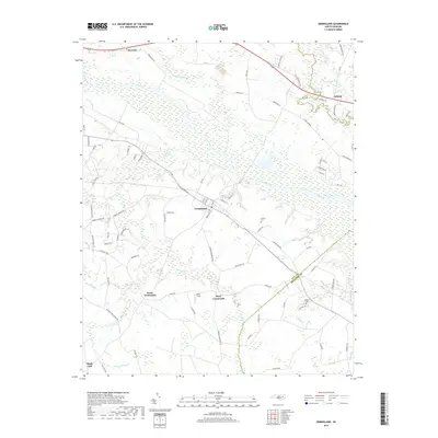
2019 Map of Grimesland
USGS Topo · Published 2019About this map
The Tar River defines the landscape of this eastern North Carolina region, where the town of Grimesland sits along its southern banks. This 2019 survey documents a rural landscape where agriculture and low-lying wetlands dictate the pattern of development. The map details numerous crossroads communities and rural junctions, including Hams Crossroads, Boyd Crossroads, and Latham. To the north, the settlement of Pactolus is positioned near the swampy confluence of Grindle Creek and the river, marking a point of historic connectivity in Pitt County.
Find a feature on this map
87 named features on this map. Tap any name to fly to it.
Don’t see what you’re looking for? This feature index may not catch every label — zoom into the map to look around manually.
Map Details
Editions of this 2019 Grimesland Map
This is the sole edition of this map. No revisions or reprints were ever made.
Other maps of this area

1902 · Ayden
USGS Topo · 1:62,500

1902 · Vanceboro
USGS Topo · 1:62,500

1903 · Winterville
USGS Topo · 1:62,500

1903 · Chocowinity
USGS Topo · 1:62,500

1904 · Ayden
USGS Topo · 1:62,500

1904 · Vanceboro
USGS Topo · 1:62,500

1905 · Chocowinity
USGS Topo · 1:62,500

1905 · Winterville
USGS Topo · 1:62,500

1905 · Vanceboro
USGS Topo · 1:62,500

1951 · Hackney
USGS Topo · 1:24,000