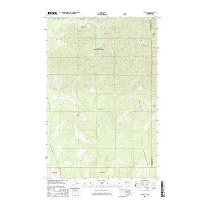
2017 Map of Grisdale
USGS Topo · Published 2017About this map
Grisdale sits within the southern reaches of the Olympic National Forest, a region defined by its dense drainage networks and timber history. The topography is dominated by prominent features like Weatherwax Ridge and Reed Hill, which overlook a complex web of waterways including the W Fork Satsop River, Canyon River, and the Little River. This 2017 survey details the extensive infrastructure of the logging industry, visible through a maze of numbered Forest Service routes such as Natl Forest Develop Road 22 Rd and several Intermittent Logging Rd paths. The map reveals how the landscape is partitioned between Grays Harbor and Mason counties, tracing the natural and surveyed boundaries that shaped the management of these timberlands. Small tributaries like Spoon Cr, Anderson Cr, and Sage Cr illustrate the fine-grained hydrology of the Olympic Mountains' foothills.
Find a feature on this map
30 named features on this map. Tap any name to fly to it.
Don’t see what you’re looking for? This feature index may not catch every label — zoom into the map to look around manually.
Map Details
Editions of this 2017 Grisdale Map
This is the sole edition of this map. No revisions or reprints were ever made.
Other maps of this area

1921 · Satsop
USGS Topo · 1:62,500

1941 · Mobray
USGS Topo · 1:62,500

1943 · Nahwatzel Lake
USGS Topo · 1:62,500

1943 · Mobray
USGS Topo · 1:62,500

1953 · Mt Tebo
USGS Topo · 1:62,500

1953 · Elma
USGS Topo · 1:62,500

1955 · Wynoochee Valley
USGS Topo · 1:62,500

1955 · Grisdale
USGS Topo · 1:62,500

1958 · Seattle
USGS Topo · 1:250,000

1962 · Seattle
USGS Topo · 1:250,000