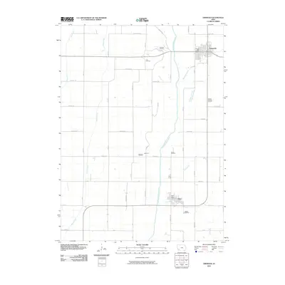
2010 Map of Griswold
USGS Topo · Published 2010About this map
Griswold and Elliott serve as the primary anchors of this southwestern Iowa landscape, situated along the corridor of the East Nishnabotna River. The topography is defined by the river’s broad valley and a network of supporting tributaries including Walnut Creek and Indian Creek, which cut through the agricultural grid. This 2010 survey illustrates a region where local heritage is preserved in a high density of rural burial grounds, such as Flint Cemetery and Mercer Cemetery, often located at the intersections of county roads like Pioneer Trl and Cheyenne Ave. The small settlement of Waveland sits further south, while the municipal centers of Griswold and Elliott maintain their historic footprints, including the Griswold Post Office and Elliott Post Office. The map captures the precision of the section-line road system that organizes the farmland, punctuated by smaller creeks like Baughmans Creek and Coe Creek as they drain toward the main river channel.
Find a feature on this map
50 named features on this map. Tap any name to fly to it.
Don’t see what you’re looking for? This feature index may not catch every label — zoom into the map to look around manually.
Map Details
Editions of this 2010 Griswold Map
This is the sole edition of this map. No revisions or reprints were ever made.
Other maps of this area

1954 · Omaha
USGS Topo · 1:250,000

1957 · Omaha
USGS Topo · 1:250,000

1958 · Omaha
USGS Topo · 1:250,000

1963 · Avoca SE
USGS Topo · 1:24,000

1971 · Atlantic SW
USGS Topo · 1:24,000

1971 · Lewis
USGS Topo · 1:24,000

1978 · Griswold
USGS Topo · 1:24,000

1978 · Wallin
USGS Topo · 1:24,000

1978 · Wales
USGS Topo · 1:24,000

1978 · Griswold NE
USGS Topo · 1:24,000