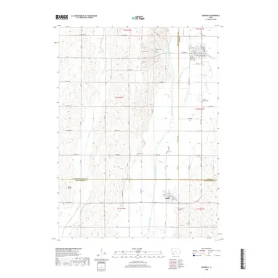
2018 Map of Griswold
USGS Topo · Published 2018About this map
Griswold and Elliott anchor this southwestern Iowa landscape where the borders of Cass, Pottawattamie, and Montgomery counties converge. The East Nishnabotna River winds south through the center of the sheet, joined by tributaries like Baughmans Cr and Clarks Br. This region is defined by its deep agricultural roots and a dense network of country roads such as Pioneer Trl and Applewood Rd, which connect a series of family and township burying grounds. Genealogists can find several notable sites including Griswold Cem, Hillside Cem, and the Pleasant Township Cem. Near the southern border, the small settlement of Elliott sits along the banks of Coe Cr, while the northern portion is dominated by the street grid of Griswold. The local geography is further marked by Shields Airport and the winding paths of Walnut Cr and Indian Cr to the west.
Find a feature on this map
51 named features on this map. Tap any name to fly to it.
Don’t see what you’re looking for? This feature index may not catch every label — zoom into the map to look around manually.
Map Details
Editions of this 2018 Griswold Map
This is the sole edition of this map. No revisions or reprints were ever made.
Other maps of this area

1954 · Omaha
USGS Topo · 1:250,000

1957 · Omaha
USGS Topo · 1:250,000

1958 · Omaha
USGS Topo · 1:250,000
1963 · Avoca SE
USGS Topo · 1:24,000
1971 · Atlantic SW
USGS Topo · 1:24,000
1971 · Lewis
USGS Topo · 1:24,000
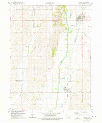
1978 · Griswold
USGS Topo · 1:24,000
1978 · Wallin
USGS Topo · 1:24,000
1978 · Wales
USGS Topo · 1:24,000
1978 · Griswold NE
USGS Topo · 1:24,000