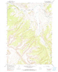
1965 Map of Grizzly Lake
USGS Topo · Published 1990About this map
Gros Ventre River carving through the heart of Teton National Forest defines the hydrology of this landscape, as documented during the mid-1960s. The terrain is characterized by a complex network of drainages and high-elevation landforms, from the Red Hills and Haystack in the north to the secluded Hidden Basin in the south. The primary human imprint is concentrated near the river valley at Red Rock Ranch, while the surrounding wilderness is accessible only by a system of Pack Trails and a single Jeep Trail.
Find a feature on this map
19 named features on this map. Tap any name to fly to it.
Don’t see what you’re looking for? This feature index may not catch every label — zoom into the map to look around manually.
Map Details
Editions of this 1965 Grizzly Lake Map
4 editions found
Other maps of this area

1899 · Grand Teton
USGS Topo · 1:125,000

1901 · Grand Teton
USGS Topo · 1:125,000

1902 · Mt Leidy
USGS Topo · 1:125,000

1907 · Gros Ventre
USGS Topo · 1:125,000

1910 · Gros Ventre
USGS Topo · 1:125,000

1931 · Jackson
USGS Topo · 1:125,000

1935 · Jackson
USGS Topo · 1:125,000

1955 · Driggs
USGS Topo · 1:250,000

1958 · Driggs
USGS Topo · 1:250,000

1962 · Driggs
USGS Topo · 1:250,000