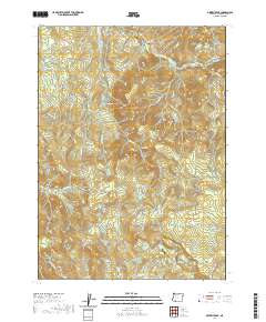
2020 Map of Grizzly Peak
USGS Topo · Published 2020About this map
Climax sits at the edge of this high-elevation landscape, where the waters of Antelope Cr flow westward toward the valley below. This part of Jackson County is defined by its complex drainage systems and volcanic peaks, featuring prominent landmarks like Grizzly Peak and Eagle Butte. The terrain is deeply carved by numerous watercourses, including the South Fork Little Butte Creek and Lost Cr, which feeds into the Lost Creek Reservoir.
Find a feature on this map
53 named features on this map. Tap any name to fly to it.
Don’t see what you’re looking for? This feature index may not catch every label — zoom into the map to look around manually.
Map Details
Editions of this 2020 Grizzly Peak Map
This is the sole edition of this map. No revisions or reprints were ever made.
Other maps of this area

1891 · Ashland
USGS Topo · 1:250,000

1893 · Ashland
USGS Topo · 1:250,000

1897 · Ashland
USGS Topo · 1:250,000

1938 · Medford
USGS Topo · 1:125,000

1954 · Lakecreek
USGS Topo · 1:62,500

1954 · Ashland
USGS Topo · 1:62,500

1955 · Hyatt Reservoir
USGS Topo · 1:62,500

1955 · Mt. Mc Loughlin
USGS Topo · 1:62,500

1955 · Medford
USGS Topo · 1:250,000

1957 · Medford
USGS Topo · 1:250,000