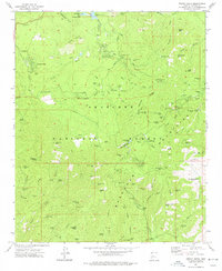
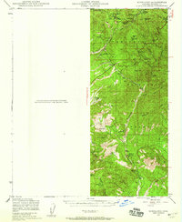
1974 Map of Groom Creek
USGS Topo · Published 1977About this map
The Bradshaw Mountains dominate this 1970s landscape, revealing a dense network of mining claims and high-altitude settlements within the Prescott National Forest. The map documents a legacy of extraction, where historic sites like the Jersey Lily Mine, Goldwater Mine, and the Tilly Starbuck Mine are scattered across deep canyons and ridges. Small enclaves and seasonal outposts such as Groom Creek, Walker, and Potato Patch are connected by the winding Senator Highway, reflecting the transition of the area from a pure mining district into a recreational and residential retreat.
Find a feature on this map
104 named features on this map. Tap any name to fly to it.
Don’t see what you’re looking for? This feature index may not catch every label — zoom into the map to look around manually.
Map Details
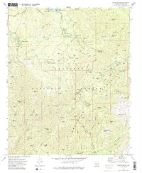
Editions of this 1974 Groom Creek Map
2 editions found
Other maps of this area

1887 · Prescott
USGS Topo · 1:250,000

1892 · Prescott
USGS Topo · 1:250,000

1903 · Bradshaw Mountains
USGS Topo · 1:125,000

1903 · Congress
USGS Topo · 1:125,000

1904 · Congress
USGS Topo · 1:125,000

1905 · Jerome
USGS Topo · 1:125,000
1947 · Iron Springs
USGS Topo · 1:62,500
1947 · Mt. Union
USGS Topo · 1:62,500
1947 · Kirkland
USGS Topo · 1:62,500
1947 · Prescott
USGS Topo · 1:62,500