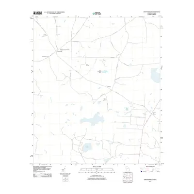
2011 Map of Grooverville
USGS Topo · Published 2011About this map
Grooverville and the community of Piscola define this Brooks County landscape, where small rural settlements are linked by a network of local roads such as Grooverville Rd and Ramsey Rd. The area is notably dense with burial sites that serve as important markers for genealogists and local historians, including the African Methodist Episcopal Cemetery, Saint Philip Cemetery, and Simmons Hill Cemetery.
Find a feature on this map
35 named features on this map. Tap any name to fly to it.
Don’t see what you’re looking for? This feature index may not catch every label — zoom into the map to look around manually.
Map Details
Editions of this 2011 Grooverville Map
This is the sole edition of this map. No revisions or reprints were ever made.
Other maps of this area

1954 · Valdosta
USGS Topo · 1:250,000

1956 · Grooverville
USGS Topo · 1:24,000

1956 · Monticello NE
USGS Topo · 1:24,000

1956 · Baden
USGS Topo · 1:24,000

1957 · Thomasville
USGS Topo · 1:62,500

1958 · Valdosta
USGS Topo · 1:250,000

1959 · Valdosta
USGS Topo · 1:250,000

1961 · Quitman
USGS Topo · 1:62,500

1962 · Ashville
USGS Topo · 1:24,000
1962 · Hamburg
USGS Topo · 1:24,000