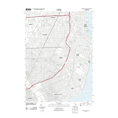
2011 Map of Grosse Pointe
USGS Topo · Published 2011About this map
Lake St Clair defines the eastern edge of this coastal landscape, where the dense suburban grid of the Detroit metropolitan area meets the water. The survey reveals a corridor of affluent residential communities including Grosse Pointe Park, Grosse Pointe Farms, and Grosse Pointe Shores. These neighborhoods are characterized by winding residential ways and prestigious educational institutions like Detroit University School and University-Liggett School. Further inland, the character shifts toward more uniform street patterns in Eastpointe, where the East Detroit Post Office remains a central landmark. The industrial and maritime legacy of the region is visible at the Jefferson Beach Marina and along the small waterways of Milk River and Conners Creek, illustrating how the urban expansion of the early 21st century integrated with the natural shoreline of the Great Lakes system.
Find a feature on this map
29 named features on this map. Tap any name to fly to it.
Don’t see what you’re looking for? This feature index may not catch every label — zoom into the map to look around manually.
Map Details
Editions of this 2011 Grosse Pointe Map
This is the sole edition of this map. No revisions or reprints were ever made.
Other maps of this area

1905 · Detroit
USGS Topo · 1:62,500

1905 · Grosse Pointe
USGS Topo · 1:62,500

1908 · Rochester
USGS Topo · 1:62,500

1912 · Mt Clemens
USGS Topo · 1:62,500

1918 · Detroit
USGS Topo · 1:62,500

1918 · Grosse Pointe
USGS Topo · 1:62,500

1924 · Detroit
USGS Topo · 1:62,500

1929 · Mt Clemens
USGS Topo · 1:62,500

1934 · Detroit
USGS Topo · 1:62,500

1936 · Warren
USGS Topo · 1:31,680