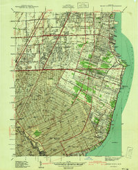
1940 Map of Grosse Pointe
USGS Topo · Published 1940About this map
The suburban expansion of City of Detroit and the Lake St. Clair shoreline are documented in this 1940 preliminary edition, surveyed just before the wartime industrial boom. The map illustrates a landscape in transition, where the rigid grid of the city meets the established coastal communities of Grosse Pointe, Grosse Pointe Farms, and Grosse Pointe Park. Recreational and aviation history is prominent, featuring the Gratiot Airport and the sprawling Grosse Pointe Yacht Club near Gaukler Pt.
Find a feature on this map
110 named features on this map. Tap any name to fly to it.
Don’t see what you’re looking for? This feature index may not catch every label — zoom into the map to look around manually.
Map Details
Editions of this 1940 Grosse Pointe Map
This is the sole edition of this map. No revisions or reprints were ever made.
Other maps of this area

1905 · Detroit
USGS Topo · 1:62,500

1905 · Grosse Pointe
USGS Topo · 1:62,500

1908 · Rochester
USGS Topo · 1:62,500

1912 · Mt Clemens
USGS Topo · 1:62,500

1918 · Detroit
USGS Topo · 1:62,500

1918 · Grosse Pointe
USGS Topo · 1:62,500

1924 · Detroit
USGS Topo · 1:62,500

1929 · Mt Clemens
USGS Topo · 1:62,500

1934 · Detroit
USGS Topo · 1:62,500

1936 · Warren
USGS Topo · 1:31,680