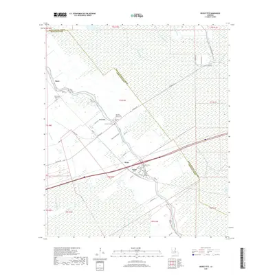
2018 Map of Grosse Tete
USGS Topo · Published 2018About this map
Bayou Grosse Tete anchors this Iberville Parish landscape, tracing a winding course that has long dictated the placement of settlements and transport corridors in this portion of Louisiana. The community of Rosedale and the village of Grosse Tete follow the bayou's banks, connected by Rosedale Rd and Sidney Rd. The map reveals a high density of small cemeteries and parish churches, such as Mount Gideon Baptist Cem and Rose Hill Cem, which serve as vital markers for genealogical research. Surrounding these clustered settlements, the terrain is defined by a sophisticated network of drainage and transport infrastructure, including Trinity Canal, King Ditch, and Catfish Canal, highlighting the intersection of natural waterways and human engineering required to manage the low-lying wetlands of the Atchafalaya Basin periphery.
Find a feature on this map
62 named features on this map. Tap any name to fly to it.
Don’t see what you’re looking for? This feature index may not catch every label — zoom into the map to look around manually.
Map Details
Editions of this 2018 Grosse Tete Map
This is the sole edition of this map. No revisions or reprints were ever made.
Other maps of this area

1906 · Bayou Sara
USGS Topo · 1:125,000

1935 · Osca Bayou
USGS Topo · 1:62,500

1939 · Fordoche
USGS Topo · 1:62,500

1940 · Grosse Tete
USGS Topo · 1:62,500

1953 · Cow Bayou
USGS Topo · 1:24,000

1953 · Lobdell
USGS Topo · 1:24,000

1953 · Maringouin
USGS Topo · 1:24,000

1953 · Addis
USGS Topo · 1:24,000

1953 · Grosse Tete SW
USGS Topo · 1:24,000

1954 · Walls
USGS Topo · 1:24,000