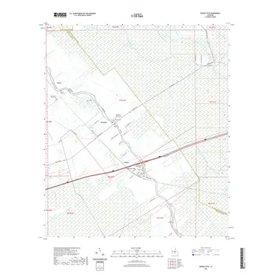
2020 Map of Grosse Tete
USGS Topo · Published 2020About this map
Bayou Grosse Tete serves as the central artery for this Iberville Parish landscape, winding through the settlements of Rosedale and Grosse Tete. The map captures a detailed inventory of local heritage sites, particularly concentrated around the bayou's banks where Rosedale Cem and the Episcopal Church of the Nativity Grave are located. The surrounding terrain is a network of low-lying wetlands and drainage features like Catfish Canal and Trinity Canal, reflecting the complex water management required in this Mississippi River delta region. Smaller hamlets like Slacks and Webre appear alongside significant family and community landmarks, including Mount Spur Cem and Saint Joseph Cem. The presence of several Baptist congregations, such as New Mount Olive Baptist Cem and New Light Baptist Cem, alongside established plantations like Trinity Plantation Rd, illustrates the deeply rooted social and agricultural history of the Louisiana bayou country.
Find a feature on this map
63 named features on this map. Tap any name to fly to it.
Don’t see what you’re looking for? This feature index may not catch every label — zoom into the map to look around manually.
Map Details
Editions of this 2020 Grosse Tete Map
This is the sole edition of this map. No revisions or reprints were ever made.
Other maps of this area

1906 · Bayou Sara
USGS Topo · 1:125,000

1935 · Osca Bayou
USGS Topo · 1:62,500

1939 · Fordoche
USGS Topo · 1:62,500

1940 · Grosse Tete
USGS Topo · 1:62,500

1953 · Cow Bayou
USGS Topo · 1:24,000

1953 · Lobdell
USGS Topo · 1:24,000

1953 · Maringouin
USGS Topo · 1:24,000

1953 · Addis
USGS Topo · 1:24,000

1953 · Grosse Tete SW
USGS Topo · 1:24,000

1954 · Walls
USGS Topo · 1:24,000