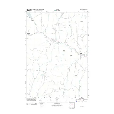
2012 Map of Groton
USGS Topo · Published 2012About this map
The Wells River corridor serves as the primary axis of settlement in this part of Vermont, connecting the villages of West Groton, Groton, and South Ryegate. The landscape is defined by the steep elevation changes between summits like Blue Mountain and Burnham Mountain and the narrow valleys carved by numerous waterways such as Scott Brook and Tannery Brook. Evidence of the area's agricultural and industrial heritage is found in the many cemeteries dotting the hillsides, including North Ryegate Cem, Jefferson Hill Cem, and the uniquely named Lime Kiln Cem. In the northwest corner, Ricker Mills sits near Ricker Pond, marking a historic site of water-powered industry. The distribution of local roads like Goodfellow Rd and Little Italy Rd suggests a community shaped by family-owned parcels and distinct neighborhoods scattered across the granite-underlain terrain.
Find a feature on this map
111 named features on this map. Tap any name to fly to it.
Don’t see what you’re looking for? This feature index may not catch every label — zoom into the map to look around manually.
Map Details
Editions of this 2012 Groton Map
This is the sole edition of this map. No revisions or reprints were ever made.
Other maps of this area

1931 · Woodsville
USGS Topo · 1:48,000

1935 · Woodsville
USGS Topo · 1:62,500

1938 · St. Johnsbury
USGS Topo · 1:48,000

1939 · Plainfield
USGS Topo · 1:48,000

1940 · Plainfield
USGS Topo · 1:62,500

1941 · Woodsville
USGS Topo · 1:62,500

1943 · Plainfield
USGS Topo · 1:62,500

1943 · St. Johnsbury
USGS Topo · 1:62,500

1947 · Corinth
USGS Topo · 1:62,500

1948 · East Barre
USGS Topo · 1:62,500