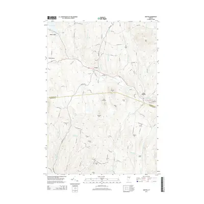
2015 Map of Groton
USGS Topo · Published 2015About this map
Wells River flows through the heart of this Vermont landscape, threading together a series of long-established settlements and upland farming areas. The village of Groton serves as a central hub, flanked by outlying communities like Ricker Mills and West Groton to the west and South Ryegate to the east. The terrain is defined by prominent peaks including Blue Mtn and Whitcher Mtn, while the southern reaches descend toward Scotch Hollow. Numerous family-named landmarks and historic burying grounds are preserved here, including the Huckins-Caldwell Hill Cem and Lime Kiln Cem, reflecting the deep-rooted genealogy of the region. Water remains a defining feature, from the quiet waters of Ricker Pond and Eastman Pond to the network of brooks such as Tannery Brook and Peach Brook that drain the timbered slopes.
Find a feature on this map
107 named features on this map. Tap any name to fly to it.
Don’t see what you’re looking for? This feature index may not catch every label — zoom into the map to look around manually.
Map Details
Editions of this 2015 Groton Map
This is the sole edition of this map. No revisions or reprints were ever made.
Other maps of this area

1931 · Woodsville
USGS Topo · 1:48,000

1935 · Woodsville
USGS Topo · 1:62,500

1938 · St. Johnsbury
USGS Topo · 1:48,000

1939 · Plainfield
USGS Topo · 1:48,000

1940 · Plainfield
USGS Topo · 1:62,500

1941 · Woodsville
USGS Topo · 1:62,500

1943 · Plainfield
USGS Topo · 1:62,500

1943 · St. Johnsbury
USGS Topo · 1:62,500

1947 · Corinth
USGS Topo · 1:62,500

1948 · East Barre
USGS Topo · 1:62,500