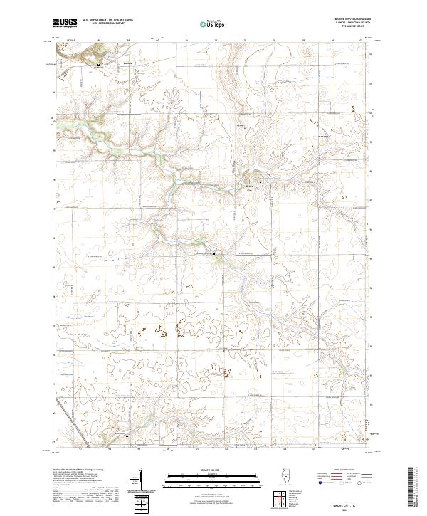
2024 Map of Grove City
USGS Topo · Published 2024About this map
Buckhart Creek meanders through this agricultural landscape in Christian County, defining the drainage patterns that shaped local settlement around Grove City and Bolivia. The terrain is characterized by subtle elevation changes, most notably along Sand Ridge, which rises above the surrounding creek bottomlands. This contemporary survey reveals a geography deeply rooted in its early community foundations, evidenced by the distribution of local burial grounds and places of worship. Genealogists and local historians will find several key landmarks preserved, including the Grove City Methodist Cem and the Buckhart Reformed Church Cem located further south. The map documents a strictly organized grid of county roads, such as E 2600 North Rd and N 1000 East Rd, which continue to facilitate the movement of goods and people across this fertile Illinois prairie.
Find a feature on this map
48 named features on this map. Tap any name to fly to it.
Don’t see what you’re looking for? This feature index may not catch every label — zoom into the map to look around manually.
Map Details
Editions of this 2024 Grove City Map
This is the sole edition of this map. No revisions or reprints were ever made.
Other maps of this area

1923 · Taylorville
USGS Topo · 1:62,500

1925 · Taylorville
USGS Topo · 1:62,500

1952 · Assumption
USGS Topo · 1:62,500

1954 · Niantic
USGS Topo · 1:62,500

1954 · Mechanicsburg
USGS Topo · 1:62,500

1958 · Decatur
USGS Topo · 1:250,000

1961 · Decatur
USGS Topo · 1:250,000

1974 · Willeys
USGS Topo · 1:24,000
1982 · Mechanicsburg
USGS Topo · 1:24,000
1982 · Stonington
USGS Topo · 1:24,000