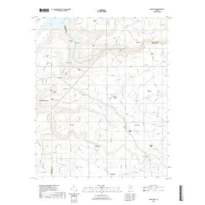
2018 Map of Grove Oak
USGS Topo · Published 2018About this map
Sand Mountain dominates the eastern half of this landscape, where the plateau is deeply incised by the drainage systems of South Sauty Creek and Town Creek. This 2018 survey reveals the dispersed rural settlement patterns typical of this portion of the Cumberland Plateau, centered around the small hubs of Grove Oak, South Hill, and Center Point. The mapping shows a significant concentration of local history markers, including Piney Grove Cem and Mount Pleasant Cem, which serve as vital anchors for genealogical research in this tri-county border area.
Find a feature on this map
137 named features on this map. Tap any name to fly to it.
Don’t see what you’re looking for? This feature index may not catch every label — zoom into the map to look around manually.
Map Details
Editions of this 2018 Grove Oak Map
This is the sole edition of this map. No revisions or reprints were ever made.
Other maps of this area

1885 · Gadsden
USGS Topo · 1:125,000

1886 · Stevenson
USGS Topo · 1:125,000

1888 · Gadsden
USGS Topo · 1:125,000

1888 · Scottsboro
USGS Topo · 1:125,000

1892 · Scottsboro
USGS Topo · 1:125,000

1892 · Stevenson
USGS Topo · 1:125,000

1892 · Gadsden
USGS Topo · 1:125,000

1893 · Fort Payne
USGS Topo · 1:125,000

1895 · Stevenson
USGS Topo · 1:125,000

1895 · Gadsden
USGS Topo · 1:125,000