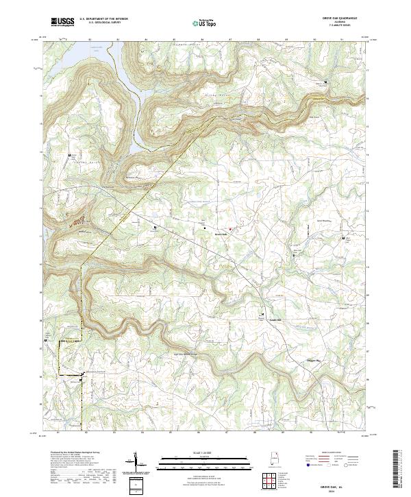
2024 Map of Grove Oak
USGS Topo · Published 2024About this map
Sand Mountain dominates the eastern half of this landscape, where the plateau drops sharply into the carved drainage of South Sauty Creek and Bucks Pocket. The terrain is defined by deep, winding coves like Morgan Cove and Tucker Cove, separated by prominent ridges including Bethune Point and Hilley Point. These geographic features dictated the settlement patterns of DeKalb, Marshall, and Jackson counties, which converge near the center of the sheet.
Find a feature on this map
137 named features on this map. Tap any name to fly to it.
Don’t see what you’re looking for? This feature index may not catch every label — zoom into the map to look around manually.
Map Details
Editions of this 2024 Grove Oak Map
This is the sole edition of this map. No revisions or reprints were ever made.
Other maps of this area

1885 · Gadsden
USGS Topo · 1:125,000

1886 · Stevenson
USGS Topo · 1:125,000

1888 · Gadsden
USGS Topo · 1:125,000

1888 · Scottsboro
USGS Topo · 1:125,000

1892 · Scottsboro
USGS Topo · 1:125,000

1892 · Stevenson
USGS Topo · 1:125,000

1892 · Gadsden
USGS Topo · 1:125,000

1893 · Fort Payne
USGS Topo · 1:125,000

1895 · Stevenson
USGS Topo · 1:125,000

1895 · Gadsden
USGS Topo · 1:125,000