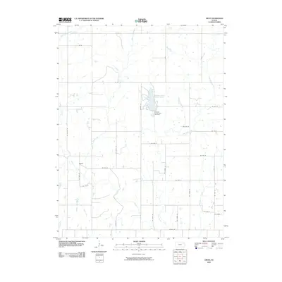
2009 Map of Grove
USGS Topo · Published 2009About this map
Grove sits as the central settlement in this portion of Shawnee County, appearing as a quiet rural hub in the late 2000s. The landscape is defined by the dendritic drainage patterns of Soldier Creek and its many tributaries, including Little Soldier Creek and Walnut Creek, which carve through the plains. A significant recreational landmark, the Shawnee State Fishing Lake, is held by the Shawnee County State Lake Dam in the northeastern quadrant, serving as a primary water feature for the local area.
Find a feature on this map
32 named features on this map. Tap any name to fly to it.
Don’t see what you’re looking for? This feature index may not catch every label — zoom into the map to look around manually.
Map Details
Editions of this 2009 Grove Map
This is the sole edition of this map. No revisions or reprints were ever made.
Other maps of this area

1889 · Topeka
USGS Topo · 1:125,000

1894 · Topeka
USGS Topo · 1:125,000

1950 · Kansas City
USGS Topo · 1:250,000

1950 · Topeka
USGS Topo · 1:24,000

1951 · Topeka
USGS Topo · 1:24,000

1952 · Rossville
USGS Topo · 1:24,000

1952 · Silver Lake
USGS Topo · 1:24,000

1952 · Elmont
USGS Topo · 1:24,000

1952 · Grove
USGS Topo · 1:24,000
1952 · Willard
USGS Topo · 1:24,000