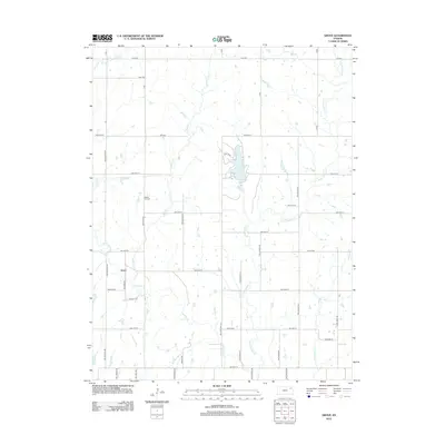
2012 Map of Grove
USGS Topo · Published 2012About this map
Grove serves as a central anchor in this rural Kansas landscape, situated near the headwaters of Soldier Cr and Walnut Cr. The geography is defined by a dense network of meandering waterways, including Little Soldier Cr and Messhoss Cr, which carve through the undulating prairie. A significant landmark for the area is the Shawnee County State Lake, providing a major water feature in the northern section of the quadrangle. Genealogists will find the Walnut Hill Cem positioned between the drainage of Walnut and Soldier Creeks, a common placement for early burial grounds. The map reflects a structured grid of rural roads such as NW Valencia Rd and 110th Rd, which organize the agricultural holdings and connections between localized settlements in this part of Shawnee County.
Find a feature on this map
25 named features on this map. Tap any name to fly to it.
Don’t see what you’re looking for? This feature index may not catch every label — zoom into the map to look around manually.
Map Details
Editions of this 2012 Grove Map
This is the sole edition of this map. No revisions or reprints were ever made.
Other maps of this area

1889 · Topeka
USGS Topo · 1:125,000

1894 · Topeka
USGS Topo · 1:125,000

1950 · Kansas City
USGS Topo · 1:250,000

1950 · Topeka
USGS Topo · 1:24,000

1951 · Topeka
USGS Topo · 1:24,000

1952 · Rossville
USGS Topo · 1:24,000

1952 · Silver Lake
USGS Topo · 1:24,000

1952 · Elmont
USGS Topo · 1:24,000

1952 · Grove
USGS Topo · 1:24,000
1952 · Willard
USGS Topo · 1:24,000