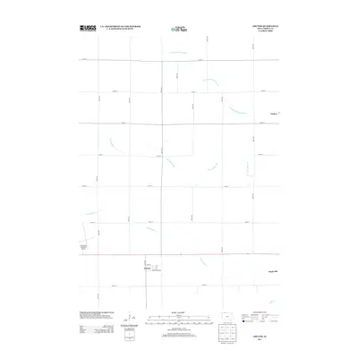
2013 Map of Gruver
USGS Topo · Published 2013About this map
The small town of Gruver sits at the intersection of local routes in a landscape defined by an extensive agricultural drainage network. Surveyed in 2013, the area shows the systematic transformation of the prairie into a grid of productive farmland, evidenced by the prominent paths of County Ditch Number 53, Ditch Number 40, and Ditch Number 7. These waterways are the lifeblood of the county's economy, managing the local watershed to support the surrounding fields.
Find a feature on this map
24 named features on this map. Tap any name to fly to it.
Don’t see what you’re looking for? This feature index may not catch every label — zoom into the map to look around manually.
Map Details
Editions of this 2013 Gruver Map
This is the sole edition of this map. No revisions or reprints were ever made.
Other maps of this area

1954 · Fairmont
USGS Topo · 1:250,000

1958 · Fairmont
USGS Topo · 1:250,000

1970 · Ceylon
USGS Topo · 1:24,000

1970 · Dunnell
USGS Topo · 1:24,000

1970 · Wilbert
USGS Topo · 1:24,000

1972 · Wallingford
USGS Topo · 1:24,000

1972 · Estherville
USGS Topo · 1:24,000

1980 · Ringsted
USGS Topo · 1:24,000

1980 · Ingham Lake
USGS Topo · 1:24,000

1980 · Gruver
USGS Topo · 1:24,000