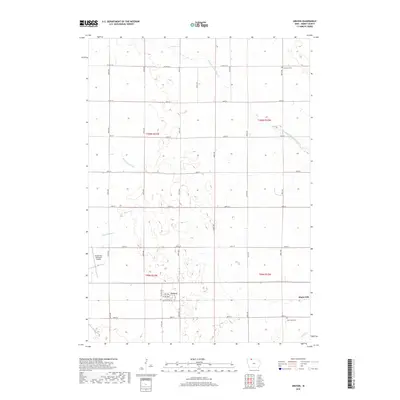
2018 Map of Gruver
USGS Topo · Published 2018About this map
The small prairie town of Gruver serves as the focal point of this Emmet County landscape, where the grid-iron geometry of agricultural life is clearly etched into the Iowa terrain. Settled in the late nineteenth century as a railroad stop, the community is mapped here with its core streets like 1st Ave and Agriculture Ave. The surrounding countryside reveals a highly engineered watershed, defined by a complex network of drainage systems including County Ditch Number 53 and Ditch Number 40, which were essential for converting the natural wetlands of this region into productive farmland.
Find a feature on this map
31 named features on this map. Tap any name to fly to it.
Don’t see what you’re looking for? This feature index may not catch every label — zoom into the map to look around manually.
Map Details
Editions of this 2018 Gruver Map
This is the sole edition of this map. No revisions or reprints were ever made.
Other maps of this area

1954 · Fairmont
USGS Topo · 1:250,000

1958 · Fairmont
USGS Topo · 1:250,000

1970 · Ceylon
USGS Topo · 1:24,000

1970 · Dunnell
USGS Topo · 1:24,000

1970 · Wilbert
USGS Topo · 1:24,000

1972 · Wallingford
USGS Topo · 1:24,000

1972 · Estherville
USGS Topo · 1:24,000

1980 · Ringsted
USGS Topo · 1:24,000

1980 · Ingham Lake
USGS Topo · 1:24,000

1980 · Gruver
USGS Topo · 1:24,000