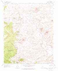
1961 Map of Guadalupe
USGS Topo · Published 1975About this map
Guadalupe and its surrounding canyonlands are documented here in the early 1960s, revealing a landscape defined by volcanic landforms and intermittent water sources. The settlement sits near the Guadalupe Cem at the confluence of several significant drainages, including Cañon Guadalupe and the Rio Puerco. The topography is marked by numerous cerros, or isolated hills, such as Cerro de Guadalupe and Cerro Chamisa Losa, which rise above the surrounding flats. Water remains the critical factor for life in this arid region, evidenced by the many named springs like Guadalupe Springs and Ojo del Padre. The western portion of the map covers the Grant Boundary where the land ascends into the Cibola National Forest and the Ignacio Chavez area. A Gaging Station on the Rio Puerco indicates the importance of monitoring the erratic flow of these desert waterways.
Find a feature on this map
39 named features on this map. Tap any name to fly to it.
Don’t see what you’re looking for? This feature index may not catch every label — zoom into the map to look around manually.
Map Details
Editions of this 1961 Guadalupe Map

Other maps of this area

1883 · Mt. Taylor
USGS Topo · 1:250,000

1886 · Mt. Taylor
USGS Topo · 1:250,000

1892 · Mt. Taylor
USGS Topo · 1:250,000

1899 · Mt. Taylor
USGS Topo · 1:250,000

1958 · Albuquerque
USGS Topo · 1:250,000

1961 · Cerro Parido
USGS Topo · 1:24,000

1961 · Cerro Tinaja
USGS Topo · 1:24,000

1961 · Arroyo Empedrado
USGS Topo · 1:24,000
1961 · Canada Calladita
USGS Topo · 1:24,000
1961 · Laguna Seca
USGS Topo · 1:24,000