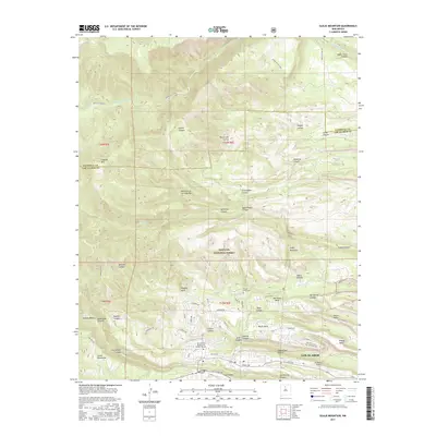
2017 Map of Guaje Mountain
USGS Topo · Published 2017About this map
Los Alamos sits atop a series of finger-like plateaus, its residential and institutional layout defined by the dramatic incisions of canyon geology. The town is flanked by numerous mesas, including North Mesa, Barrancas Mesa, Otowi Mesa, and Kwage Mesa, which are separated by deep drainages such as Bayo Canyon and Pueblo Canyon. This intricate network of level heights and steep descents dictates the path of local roads like Diamond Dr and San Ildefonso Rd. To the north, the terrain rises toward Guaje Mountain and the Santa Fe National Forest, where the landscape is carved by a dense series of canyons including Rendija Canyon and Chupaderos Canyon. This 2017 survey highlights the modern infrastructure of the area, from the Univ of New Mexico-Los Alamos Campus to the Los Alamos Airport, showing how the community has integrated into this complex volcanic topography.
Find a feature on this map
74 named features on this map. Tap any name to fly to it.
Don’t see what you’re looking for? This feature index may not catch every label — zoom into the map to look around manually.
Map Details
Editions of this 2017 Guaje Mountain Map
This is the sole edition of this map. No revisions or reprints were ever made.
Other maps of this area

1892 · Santa Clara
USGS Topo · 1:125,000

1918 · Abiquiu
USGS Topo · 1:125,000

1952 · White Rock
USGS Topo · 1:24,000

1952 · Valle Toledo
USGS Topo · 1:24,000

1952 · Frijoles
USGS Topo · 1:24,000

1952 · Puye
USGS Topo · 1:24,000

1952 · Guaje Mountain
USGS Topo · 1:24,000

1953 · Chili
USGS Topo · 1:24,000

1953 · Vallecitos
USGS Topo · 1:24,000

1953 · Polvadera Peak
USGS Topo · 1:24,000