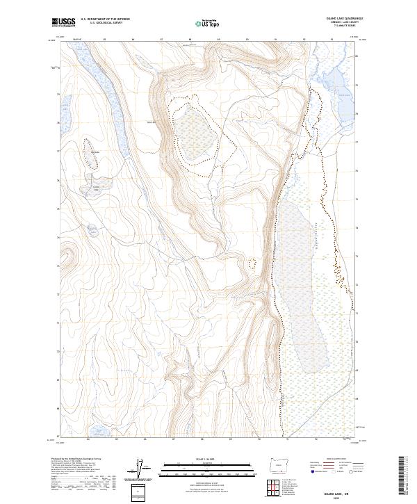
2023 Map of Guano Lake
USGS Topo · Published 2023About this map
Guano Valley and the prominent escarpment of Shirk Rim dominate this high-desert landscape in Lake County. The drainage patterns of Jack Creek and Guano Creek define the low-lying basins, which are dotted with seasonal water bodies such as Jack Lake, Egg Lake, and Corral Lake. This terrain reflects a classic Great Basin hydrology where water collects in shallow depressions like Shirk Lake and Round Lake rather than reaching the sea. Access is limited to Bureau of Land Management routes, including BLM RD 7136-0-00 and BLM RD 6106-0-00, which navigate the elevation changes between the valley floor and the surrounding plateaus. The inclusion of Little Reservoir suggests historical efforts to manage water resources for livestock in this arid environment.
Find a feature on this map
20 named features on this map. Tap any name to fly to it.
Don’t see what you’re looking for? This feature index may not catch every label — zoom into the map to look around manually.
Map Details
Editions of this 2023 Guano Lake Map
This is the sole edition of this map. No revisions or reprints were ever made.
Other maps of this area

1955 · Adel
USGS Topo · 1:250,000

1957 · Adel
USGS Topo · 1:250,000

1958 · Adel
USGS Topo · 1:250,000

1962 · Adel
USGS Topo · 1:250,000

1967 · Jacobs Reservoir
USGS Topo · 1:24,000

1967 · Alger Lake
USGS Topo · 1:24,000
1968 · Piute Reservoir
USGS Topo · 1:24,000

1968 · Guano Lake
USGS Topo · 1:24,000
1968 · Blizzard Gap
USGS Topo · 1:24,000
1968 · Mud Lake Reservoir
USGS Topo · 1:24,000