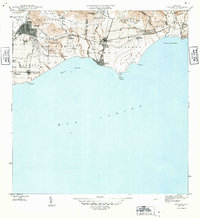
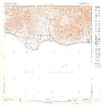
1946 Map of Guayama
USGS Topo · Published 1946About this map
Agricultural sugar estates and coastal commerce dominate this 1940s landscape along the Mar Caribe. The region is anchored by the industrial centers of Central Machete and Central Lafayette, which served as the economic heart of the Guayama and Arroyo municipalities. A dense network of colonial estates, such as Hacienda Carlota, Colonia Santa Elena, and Colonia Vives, illustrates the land-use patterns of the era, where residential life was closely tied to sugar production.
Find a feature on this map
55 named features on this map. Tap any name to fly to it.
Don’t see what you’re looking for? This feature index may not catch every label — zoom into the map to look around manually.
Map Details
Editions of this 1946 Guayama Map
4 editions found
Other maps of this area

1945 · Punta Tuna
USGS Topo · 1:30,000

1945 · Central Aguirre
USGS Topo · 1:30,000

1946 · Patillas
USGS Topo · 1:30,000

1946 · Cayey
USGS Topo · 1:30,000

1946 · Yabucoa
USGS Topo · 1:30,000

1946 · Guayama
USGS Topo · 1:30,000

1947 · Yabucoa SO
USGS Topo · 1:10,000

1947 · Patillas SO
USGS Topo · 1:10,000
1947 · Guayama NE
USGS Topo · 1:10,000
1947 · Punta Tuna NO
USGS Topo · 1:10,000