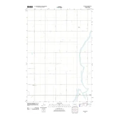
2011 Map of Guelph
USGS Topo · Published 2011About this map
The James River snakes through the eastern section of this North Dakota landscape, carving a wandering path through a grid of rural section lines. This 2011 survey captures the quiet agricultural character of the region, anchored by the small settlements of Guelph in the southwest and Ludden in the southeast. The area is defined by its rectilinear road network, including thoroughfares like 98th St SE and 108th Ave SE, which connect isolated farmsteads and local landmarks. To the southeast, the Ludden Cemetery provides a focal point for local genealogical interest, while the presence of Spear Airport north of the river suggests the continued importance of small-scale aviation for this prairie community.
Find a feature on this map
21 named features on this map. Tap any name to fly to it.
Don’t see what you’re looking for? This feature index may not catch every label — zoom into the map to look around manually.
Map Details
Editions of this 2011 Guelph Map
This is the sole edition of this map. No revisions or reprints were ever made.
Other maps of this area

1894 · Hecla
USGS Topo · 1:62,500

1894 · Savo
USGS Topo · 1:62,500

1894 · Fullerton
USGS Topo · 1:62,500

1894 · Oakes
USGS Topo · 1:62,500

1895 · Lamoure
USGS Topo · 1:125,000

1896 · Columbia
USGS Topo · 1:125,000

1918 · La Moure
USGS Topo · 1:125,000

1952 · Glover
USGS Topo · 1:24,000

1952 · Oakes
USGS Topo · 1:24,000

1953 · Jamestown
USGS Topo · 1:250,000