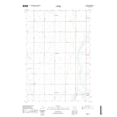
2020 Map of Guelph
USGS Topo · Published 2020About this map
James River meanders through the eastern edge of this Dickey County landscape, defining the local topography as it flows southward past the small community of Ludden. The terrain is characterized by a dense network of wetlands and seasonal basins typical of the Glacial Lake Agassiz region, interlaced with a strictly rectangular grid of section-line roads like 97th St SE and 103rd Ave SE. The settlement of Guelph serves as a local landmark in the southwestern portion of the sheet, reflecting the area's agricultural heritage. For those researching local family history, the Ludden Cem is a primary site of interest, situated near the riverbanks just outside the namesake town. The map reveals the precise intersection of rail and road corridors that once facilitated the movement of grain and goods through this rural prairie environment.
Find a feature on this map
27 named features on this map. Tap any name to fly to it.
Don’t see what you’re looking for? This feature index may not catch every label — zoom into the map to look around manually.
Map Details
Editions of this 2020 Guelph Map
This is the sole edition of this map. No revisions or reprints were ever made.
Other maps of this area

1894 · Hecla
USGS Topo · 1:62,500

1894 · Savo
USGS Topo · 1:62,500

1894 · Fullerton
USGS Topo · 1:62,500

1894 · Oakes
USGS Topo · 1:62,500

1895 · Lamoure
USGS Topo · 1:125,000

1896 · Columbia
USGS Topo · 1:125,000

1918 · La Moure
USGS Topo · 1:125,000

1952 · Glover
USGS Topo · 1:24,000

1952 · Oakes
USGS Topo · 1:24,000

1953 · Jamestown
USGS Topo · 1:250,000