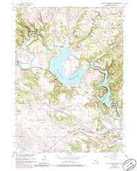
1950 Map of Guernsey Reservoir
USGS Topo · Published 1985About this map
The Old Emigrant Trail and the primary Emigrant Trail trace a historic path across the high plains here, punctuated by an Oregon Trail Marker near the southern shore of Guernsey Reservoir. This landscape, documented just after the mid-century, reveals the convergence of westward migration history and mid-20th-century infrastructure. The reservoir itself dominates the center, featuring distinct arms like Davis Bay and Newell Bay, while the North Platte River winds through the northwest.
Find a feature on this map
29 named features on this map. Tap any name to fly to it.
Don’t see what you’re looking for? This feature index may not catch every label — zoom into the map to look around manually.
Map Details
Editions of this 1950 Guernsey Reservoir Map
2 editions found
Other maps of this area

1896 · Hartville
USGS Topo · 1:125,000

1901 · Hartville
USGS Topo · 1:125,000

1950 · Guernsey
USGS Topo · 1:24,000

1950 · Herman Ranch
USGS Topo · 1:24,000

1950 · Register Cliff
USGS Topo · 1:24,000

1950 · Haushar Ranch
USGS Topo · 1:24,000

1950 · Hell Gap
USGS Topo · 1:24,000

1950 · Guernsey Reservoir
USGS Topo · 1:24,000

1951 · Haushar Ranch
USGS Topo · 1:24,000

1951 · Guernsey Reservoir
USGS Topo · 1:24,000