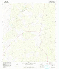
1972 Map of Guerra
USGS Topo · Published 1993About this map
The settlement of Guerra sits at the southern edge of this Jim Hogg County landscape, reflecting the sparse, resource-driven settlement patterns of South Texas in the early 1970s. The area is defined by the Colorado Field, an extensive network of petroleum extraction indicated by dozens of Oil Wells, Oil Well sites, and scattered Drill Hole locations. This industrial activity is superimposed over a traditional ranching environment, where water security is managed through specifically named landmarks such as Chicharon Windmill and Old Medanito Windmill.
Find a feature on this map
20 named features on this map. Tap any name to fly to it.
Don’t see what you’re looking for? This feature index may not catch every label — zoom into the map to look around manually.
Map Details
Editions of this 1972 Guerra Map
2 editions found
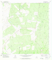
Other maps of this area

1938 · Cuevitas
USGS Topo · 1:62,500

1939 · Randado
USGS Topo · 1:62,500

1940 · Randado
USGS Topo · 1:62,500

1940 · Mogotes Hill
USGS Topo · 1:62,500

1949 · Mc Allen
USGS Topo · 1:250,000

1954 · McAllen
USGS Topo · 1:250,000

1956 · Mogotes Hill
USGS Topo · 1:62,500

1956 · Arroyo Clareno
USGS Topo · 1:62,500

1956 · Laredo
USGS Topo · 1:250,000

1957 · Mc Allen
USGS Topo · 1:250,000