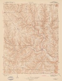
1943 Map of Guilford
USGS Topo · Published 1943About this map
Guilford sits at the confluence of the West Fork and East Fork Tanners Creek, serving as a central point in this part of Dearborn County during the early 1940s. The landscape is defined by a series of prominent ridges, including Sawdon Ridge and Ester Ridge, which channeled early settlement and road development along the high ground. Rural life is well-documented through numerous community landmarks, from the St Martins Ch in Yorkville to isolated family burial sites like Huber-Briggs Cem and Mc Cracken Cem. The map reveals a highly localized network of services, featuring schools such as Collier Sch and Pelley Sch that anchored these upland neighborhoods. Transportation follows the winding valley floors and narrow ridge tops, notably along the Yorkville Pike, reflecting the challenges posed by the deeply incised drainage of Tanners Creek and its many tributaries.
Find a feature on this map
56 named features on this map. Tap any name to fly to it.
Don’t see what you’re looking for? This feature index may not catch every label — zoom into the map to look around manually.
Map Details
Editions of this 1943 Guilford Map
2 editions found
Other maps of this area

1915 · Lawrenceburg
USGS Topo · 1:48,000

1915 · Harrison
USGS Topo · 1:48,000

1928 · Lawrenceburg
USGS Topo · 1:62,500

1932 · Lawrenceburg
USGS Topo · 1:62,500

1943 · Aurora
USGS Topo · 1:24,000

1943 · Hooven
USGS Topo · 1:24,000

1943 · Guilford
USGS Topo · 1:24,000

1943 · Lawrenceburg
USGS Topo · 1:24,000

1953 · Aurora
USGS Topo · 1:24,000

1953 · Guilford
USGS Topo · 1:24,000