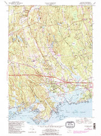
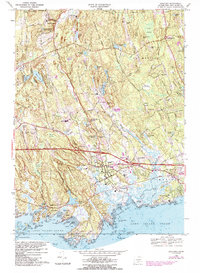
1968 Map of Guilford
USGS Topo · Published 1988About this map
Guilford and its surrounding coastal hamlets are captured here during a period of mid-century growth along the Connecticut shoreline. The town's historical maritime and agricultural identity is evident in the transition from the busy Guilford Harbor to the inland farms of North Guilford and North Madison. Transportation infrastructure, including the Connecticut Turnpike and the Amtrak line serving the Guilford Sta, illustrates the region's connection to the larger New England corridor. Extensive tracts of the Cockaponset State Forest dominate the northern terrain, interspersed with numerous ponds such as Kelsey Pond and the Guilford Lakes. Along the jagged coastline, the map details many small islands and points, including Sachem Head and Leetes Island, which retain their distinct local character. This survey also documents essential community landmarks like the Our Lady of Grace Monastery and Guilford High School during the 1960s.
Find a feature on this map
94 named features on this map. Tap any name to fly to it.
Don’t see what you’re looking for? This feature index may not catch every label — zoom into the map to look around manually.
Map Details
Editions of this 1968 Guilford Map
5 editions found
Other maps of this area

1892 · New Haven
USGS Topo · 1:62,500

1893 · Guilford
USGS Topo · 1:62,500

1921 · New Haven
USGS Topo · 1:62,500

1943 · Durham
USGS Topo · 1:25,000

1947 · Hartford
USGS Topo · 1:250,000

1948 · Hartford
USGS Topo · 1:250,000

1951 · Clinton
USGS Topo · 1:31,680

1952 · Haddam
USGS Topo · 1:31,680

1953 · Durham
USGS Topo · 1:31,680

1954 · Guilford
USGS Topo · 1:31,680