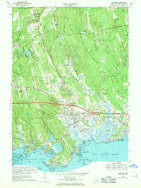
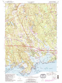
1968 Map of Guilford
USGS Topo · Published 1970About this map
Cockaponset State Forest dominates the inland landscape of this coastal survey, where the rocky terrain of Moose Hill and Walnut Hill meets the complex shoreline of Long Island Sound. The town of Guilford sits as a central hub, connected by the Connecticut Turnpike and the Penn Central railroad, with the Guilford Sta serving as a key transit point. The coastal geography is particularly intricate, featuring a dense cluster of named islands and points including Leetes Island, Sachem Head, and Horse Island.
Find a feature on this map
168 named features on this map. Tap any name to fly to it.
Don’t see what you’re looking for? This feature index may not catch every label — zoom into the map to look around manually.
Map Details
Editions of this 1968 Guilford Map
5 editions found
Other maps of this area

1892 · New Haven
USGS Topo · 1:62,500

1893 · Guilford
USGS Topo · 1:62,500

1921 · New Haven
USGS Topo · 1:62,500

1943 · Durham
USGS Topo · 1:25,000

1947 · Hartford
USGS Topo · 1:250,000

1948 · Hartford
USGS Topo · 1:250,000

1951 · Clinton
USGS Topo · 1:31,680

1952 · Haddam
USGS Topo · 1:31,680

1953 · Durham
USGS Topo · 1:31,680

1954 · Guilford
USGS Topo · 1:31,680