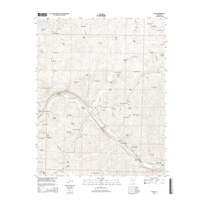
2014 Map of Guion
USGS Topo · Published 2014About this map
Guion serves as a central point along the White River, situated at the boundary of Izard Co and Stone Co in northern Arkansas. The landscape is defined by its numerous named hollows and ridges, including Beckman Hollow and Wolf Den Mtn, reflecting a settlement pattern deeply tied to the local topography. Family names and local history are preserved through sites like the McCormick Cem, Pratt Cem, and Jones Bottom Cem, which are scattered throughout the hills. Small communities and rail points like Nasco, Wolquarry, and Myersville connect the river valley to the surrounding uplands. Local landmarks such as Schoolhouse Hollow and Greasy Bottom suggest the historical locations of early rural infrastructure and land use, while water sources like Dugger Spring and Lyons Cr provide the primary drainage for this dissected plateau region.
Find a feature on this map
96 named features on this map. Tap any name to fly to it.
Don’t see what you’re looking for? This feature index may not catch every label — zoom into the map to look around manually.
Map Details
Editions of this 2014 Guion Map
This is the sole edition of this map. No revisions or reprints were ever made.
Other maps of this area

1890 · Batesville
USGS Topo · 1:125,000

1890 · Mountain Home
USGS Topo · 1:125,000

1891 · Mountain Home
USGS Topo · 1:125,000

1891 · Batesville
USGS Topo · 1:125,000

1892 · Mountain View
USGS Topo · 1:125,000

1894 · Mountain View
USGS Topo · 1:125,000

1894 · Mountain Home
USGS Topo · 1:125,000

1942 · Bethesda
USGS Topo · 1:24,000

1942 · Mt Pleasant
USGS Topo · 1:31,680

1945 · Harrison
USGS Topo · 1:250,000