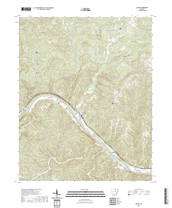
2024 Map of Guion
USGS Topo · Published 2024About this map
Guion serves as a central hub for the White River valley along the border of Izard and Stone counties. The landscape is defined by the river’s winding course, which has created agricultural pockets like Jones Bottom and Greasy Bottom, along with the prominent Pruitt Island. Settlement patterns follow the valley floor and the surrounding ridges, with smaller communities such as Nasco to the northwest and Wolquarry and Myersville to the southeast. Family history is anchored in several upland burial grounds, including McCormick Cem, Lyons Creek Cem, and Pratt Cem. The terrain is deeply dissected by numerous hollows and branches, such as Byler Branch and West Rocky Bayou, which feed into the larger river system. This modern survey illustrates how local infrastructure like Guion Rd and various county routes continue to navigate the intricate topography of the Ozark foothills.
Find a feature on this map
93 named features on this map. Tap any name to fly to it.
Don’t see what you’re looking for? This feature index may not catch every label — zoom into the map to look around manually.
Map Details
Editions of this 2024 Guion Map
This is the sole edition of this map. No revisions or reprints were ever made.
Other maps of this area

1890 · Batesville
USGS Topo · 1:125,000

1890 · Mountain Home
USGS Topo · 1:125,000

1891 · Mountain Home
USGS Topo · 1:125,000

1891 · Batesville
USGS Topo · 1:125,000

1892 · Mountain View
USGS Topo · 1:125,000

1894 · Mountain View
USGS Topo · 1:125,000

1894 · Mountain Home
USGS Topo · 1:125,000

1942 · Bethesda
USGS Topo · 1:24,000

1942 · Mt Pleasant
USGS Topo · 1:31,680

1945 · Harrison
USGS Topo · 1:250,000