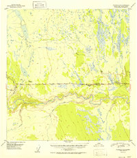
1952 Map of Gulkana A-4
USGS Topo · Published 1952About this map
The settlement of Glennallen and its immediate surroundings are captured here shortly after the completion of the Glenn Highway, which serves as the central artery for this interior Alaskan landscape. The map illustrates a developing roadside economy, marked by several early service points including Glennallen Lodge, Norms Lodge, and Georges Lodge. These establishments were critical waypoints for travelers navigating the route between Anchorage and the Richardson Highway.
Find a feature on this map
30 named features on this map. Tap any name to fly to it.
Don’t see what you’re looking for? This feature index may not catch every label — zoom into the map to look around manually.
Map Details
Editions of this 1952 Gulkana A-4 Map
2 editions found

Other maps of this area

1948 · Valdez D-5
USGS Topo · 1:63,360

1949 · Gulkana A-3
USGS Topo · 1:63,360

1949 · Gulkana A-5
USGS Topo · 1:63,360

1949 · Valdez D-4
USGS Topo · 1:63,360

1949 · Valdez D-6
USGS Topo · 1:63,360

1950 · Gulkana B-3
USGS Topo · 1:63,360

1951 · Valdez D-5
USGS Topo · 1:63,360

1951 · Gulkana
USGS Topo · 1:250,000

1951 · Valdez D-6
USGS Topo · 1:63,360

1951 · Gulkana B-5
USGS Topo · 1:63,360