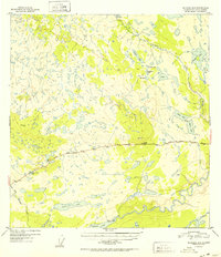
1952 Map of Gulkana A-5
USGS Topo · Published 1952About this map
The Glenn Highway serves as the primary artery through this interior Alaskan landscape, connecting isolated waypoints like the Tazlina Glacier Lodge and Atlasta House. Located in the Copper River basin area, the topography is defined by an intricate network of lakes and glacial drainages. To the south, the massive Tazlina River and Tazlina Lake dominate the lowlands, while the northern terrain is punctuated by smaller water bodies such as Frenchman Lake, Caribou Lake, and Tolsona Lake. One of the most significant cultural markers on this 1952 survey is the Indian Cem located near the shore of Tazlina Lake, providing a crucial point of interest for genealogists and local historians. The map also identifies various high points used for surveying, including VABM Tolsona 2974 and VABM Man 3154, which overlook the dense web of creeks like Mendeltna Creek and Tolsona Creek.
Find a feature on this map
23 named features on this map. Tap any name to fly to it.
Don’t see what you’re looking for? This feature index may not catch every label — zoom into the map to look around manually.
Map Details
Editions of this 1952 Gulkana A-5 Map
2 editions found

Other maps of this area

1949 · Gulkana A-5
USGS Topo · 1:63,360

1949 · Gulkana A-6
USGS Topo · 1:63,360

1949 · Valdez D-6
USGS Topo · 1:63,360

1949 · Valdez D-7
USGS Topo · 1:63,360

1950 · Gulkana B-6
USGS Topo · 1:63,360

1951 · Gulkana
USGS Topo · 1:250,000

1951 · Valdez D-6
USGS Topo · 1:63,360

1951 · Valdez D-7
USGS Topo · 1:63,360

1951 · Gulkana B-5
USGS Topo · 1:63,360

1951 · Gulkana A-4
USGS Topo · 1:63,360