
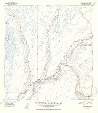
1952 Map of Gulkana B-3
USGS Topo · Published 1952About this map
The confluence of several major interior Alaskan waterways defines this landscape, where the Gakona River and Gulkana River join the braided channels of the Copper River. In the early 1950s, the small settlements of Gakona and Gulkana served as vital transit points at the junction of the Richardson Highway and the Glenn Highway. This area represents a critical intersection of road and river travel, supported by infrastructure like the local Airstrip and several benchmarked locations that guided travelers through the Copper River Meridian.
Find a feature on this map
43 named features on this map. Tap any name to fly to it.
Don’t see what you’re looking for? This feature index may not catch every label — zoom into the map to look around manually.
Map Details
Editions of this 1952 Gulkana B-3 Map
2 editions found
Other maps of this area

1949 · Gulkana A-3
USGS Topo · 1:63,360

1949 · Gulkana C-2
USGS Topo · 1:63,360

1949 · Gulkana B-2
USGS Topo · 1:63,360

1950 · Gulkana B-3
USGS Topo · 1:63,360

1950 · Gulkana C-3
USGS Topo · 1:63,360

1950 · Gulkana C-4
USGS Topo · 1:63,360

1951 · Gulkana
USGS Topo · 1:250,000

1951 · Gulkana A-4
USGS Topo · 1:63,360

1951 · Gulkana B-4
USGS Topo · 1:63,360

1952 · Gulkana A-3
USGS Topo · 1:63,360