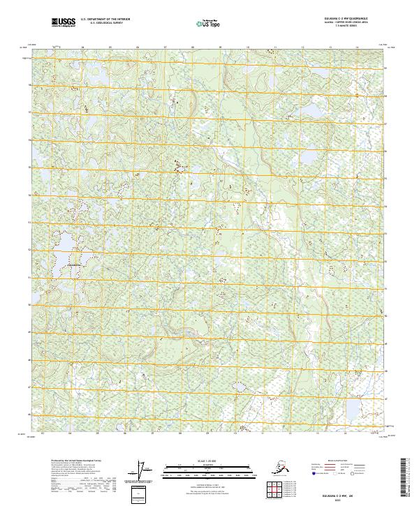
2023 Map of Gulkana C-2 NW
USGS Topo · Published 2023About this map
Chistochina sits at the edge of this interior landscape, marking a point of connection within the Copper River Census Area. The terrain is defined by the complex hydrology of the Copper River basin, where the waters of Sinona Creek and the meandering course of Tulsona Creek flow through the northern reaches of the Copper River Valley. This area represents a segment of the traditional and historical transportation corridors in East Central Alaska, where local watercourses dictated the movement of people and the establishment of seasonal camps and permanent settlements. The map highlights the vast wetland systems and intricate drainage patterns characteristic of the region, providing an essential record of the natural environment and land-use boundaries including t11n r2e and t10n r3e at this specific moment in the early twenty-first century.
Find a feature on this map
7 named features on this map. Tap any name to fly to it.
Don’t see what you’re looking for? This feature index may not catch every label — zoom into the map to look around manually.
Map Details
Editions of this 2023 Gulkana C-2 NW Map
This is the sole edition of this map. No revisions or reprints were ever made.
Other maps of this area

1949 · Gulkana C-2
USGS Topo · 1:63,360

1949 · Gulkana D-3
USGS Topo · 1:63,360

1950 · Gulkana C-3
USGS Topo · 1:63,360

1951 · Gulkana
USGS Topo · 1:250,000

1952 · Gulkana D-3
USGS Topo · 1:63,360

1952 · Gulkana C-2
USGS Topo · 1:63,360
1952 · Gulkana C-3
USGS Topo · 1:63,360
1954 · Gulkana D-2
USGS Topo · 1:63,360
1954 · Gulkana D-3
USGS Topo · 1:63,360

1959 · Gulkana
USGS Topo · 1:250,000