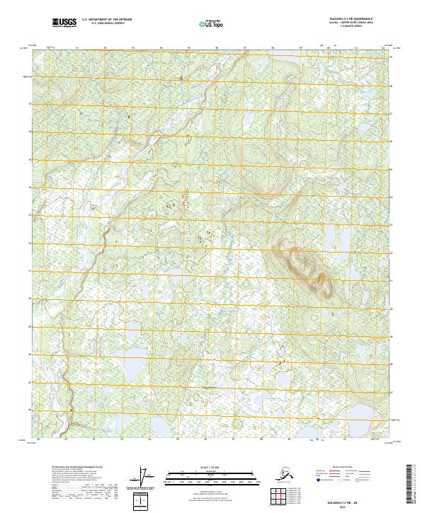
2023 Map of Gulkana C-3 NE
USGS Topo · Published 2023About this map
Chistochina sits at the southern edge of this interior landscape, where the braided channels of the Gakona River dominate the western terrain. This survey reveals a complex hydrological network defined by the river's shifting gravel bars and numerous unnamed ponds and wetlands scattered across the Copper River Census Area. The map highlights the intersection of several township boundaries, including t11n r1e, t11n r2e, t10n r1e, and t10n r2e, which provide the structural framework for this remote region. The lack of dense road networks emphasizes the reliance on natural waterways and the localized settlement pattern concentrated near the river corridor.
Find a feature on this map
6 named features on this map. Tap any name to fly to it.
Don’t see what you’re looking for? This feature index may not catch every label — zoom into the map to look around manually.
Map Details
Editions of this 2023 Gulkana C-3 NE Map
This is the sole edition of this map. No revisions or reprints were ever made.
Other maps of this area

1949 · Gulkana C-2
USGS Topo · 1:63,360

1949 · Gulkana D-3
USGS Topo · 1:63,360

1950 · Gulkana C-3
USGS Topo · 1:63,360

1951 · Gulkana
USGS Topo · 1:250,000

1952 · Gulkana D-3
USGS Topo · 1:63,360

1952 · Gulkana C-2
USGS Topo · 1:63,360
1952 · Gulkana C-3
USGS Topo · 1:63,360
1954 · Gulkana D-2
USGS Topo · 1:63,360
1954 · Gulkana D-3
USGS Topo · 1:63,360

1959 · Gulkana
USGS Topo · 1:250,000