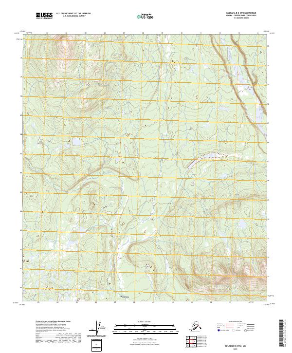
2023 Map of Gulkana D-2 SW
USGS Topo · Published 2023About this map
The Chistochina River defines the eastern boundary of this Alaskan interior landscape, flowing through a broad corridor of low-lying terrain. To the west, the topography rises into a series of drainages and upland ridges, most notably carved by Sinona Creek as it winds southward across the township grids of t12n r3e and t11n r2e. The small settlement of Chistochina appears at the southern edge of the map, marking a rare point of human habitation in a region primarily shaped by glacial waters and natural landforms. This 2023 survey illustrates the relationship between the major river system and the smaller tributary creeks that define the Copper River Census Area's wilderness character.
Find a feature on this map
9 named features on this map. Tap any name to fly to it.
Don’t see what you’re looking for? This feature index may not catch every label — zoom into the map to look around manually.
Map Details
Editions of this 2023 Gulkana D-2 SW Map
This is the sole edition of this map. No revisions or reprints were ever made.
Other maps of this area

1949 · Gulkana C-2
USGS Topo · 1:63,360

1949 · Gulkana D-3
USGS Topo · 1:63,360

1950 · Gulkana C-3
USGS Topo · 1:63,360

1951 · Gulkana
USGS Topo · 1:250,000

1952 · Gulkana D-3
USGS Topo · 1:63,360

1952 · Gulkana C-2
USGS Topo · 1:63,360
1952 · Gulkana C-3
USGS Topo · 1:63,360
1954 · Gulkana D-2
USGS Topo · 1:63,360
1954 · Gulkana D-3
USGS Topo · 1:63,360

1959 · Gulkana
USGS Topo · 1:250,000